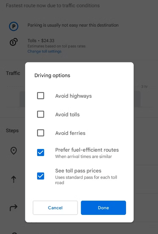
Google has updated Maps with toll-tracking data that’ll add up toll prices to show you the quickest or cheapest route. This won’t be doing much to help you with the petrol price, though.
The feature is available for users in the US, India, Japan, and Indonesia; with updates for more countries on the way. Previously, Google Maps used to just show you if a particular route has tolls.
This is still the case in SA, at least for now. The company did say more countries will follow but it didn’t mention when that’ll be or which countries the feature will expand to next.
Google en route
Google said, “you will see the estimated toll price to your destination before you start navigating thanks to trusted information from local tolling authorities.” Google also looks at toll passes, what day it is, and how much the specific toll is supposed to cost at the estimated time of travelling.
Access to the new feature is limited to Maps on Android and iOS. Nothing has been said about when the update will be available for Maps on the web.
The company first announced this feature back in April. Google collected toll prices from local authorities for nearly 2,000 roads in the featured countries.

Read More: Google launches Immersive View for Maps, and it’s glorious
It also seems like the feature isn’t fully completed yet. You don’t yet have an option to set which type of vehicle you’re driving. With different prices for bikes, cars and trucks and additional fees if you’re pulling a trailer, it seems like the feature is working off the average toll price. Hopefully we’ll see expanded options before the feature comes to SA.
Source: AndroidPolice


