


In the past few days parts of South Africa have been rocked by looting and rioting in the wake of ex-president Jacob Zuma’s arrest. The rioting began in Kwa-Zulu Natal and has spread to other parts of the country, including Gauteng, making many areas unsafe and resulting in certain roads being completely closed off.
While it’s probably best to stay home as much as you can (if you can), if you need to get around Gauteng despite the dangers, then we suggest using these maps that highlights dangerous spots around the province.
Stay safe as riots continue
The first map is a custom Google Map, created, according to its description, by Devin Hitchings. For those of you who don’t know it, you can create custom Google Maps by going over to the menu icon and selecting “Create new map”. Then you can add in a variety of custom pins and icons keyed to your liking.
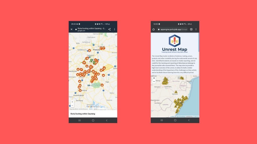
Hitchings’ map has on it markers indicating areas of Gauteng made unsafe by rioting activity, as well as useful information such as nearby police stations and hospitals. Presumably a collaboration project, the map currently shows a variety of markers mostly in and around the cities of Johannesburg and Pretoria. The description seems to indicate that anyone can contribute to the map, so long as their changes are given the go-ahead after being run by Hitchings. The full description reads:
“Red areas are no-go areas for EMS as it is not safe. Do not make changes unless verified and sent through to the creator to change. Devin Hitchings”
Below that is a counter showing that over 1 million people have already used and/or contributed to the map. With unrest at the level it currently is, we’re sure that number will go up as the day goes on.
Map Number 2 is an online map titled ‘Unrest Map’ made by PolicyLab. The pair at PolicyLab behind Unrest Map are Deci Pillay and Christopher Wood, who, according to My Broadband get their information from credible media reports.
Unrest Map shows indicators of various forms of riot activity across South Africa, in three categories labeled “Looting”, “Arson” and a catch-all “Other unrest”. Each category has its own icon on the map.
While Policy Lab does ask for user input, it says that only “incidents corroborated by official statements, news reports or clear video or photographic evidence” will be added to Unrest Map, and so relies on media outlet releases for accuracy.
Users can also click on danger icons to get more details on an area as well as the source behind the incident report.
Policy Lab said in a statement: “The map aims to provide a high-level overview of the unrest, to allow for both a better understanding of the big picture of the challenges as they unfold, and to facilitate future learning from this very difficult period.”